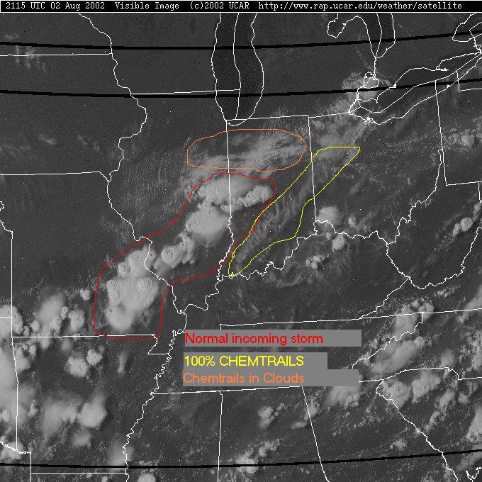
MIDWEST SERIES OF STORM BEING DIFFUSED BY CHEMTRAILS
Folks, they've got DROUGHT creation down to a science. Well, I've got watching these b**s do it down to a science too!
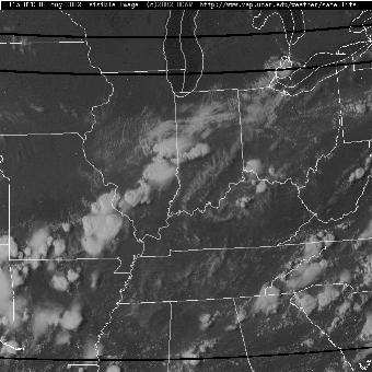
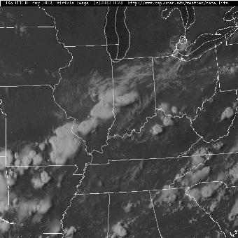
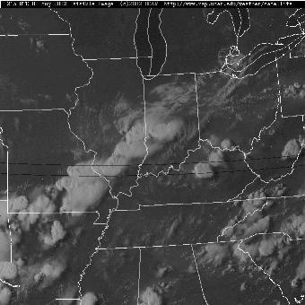
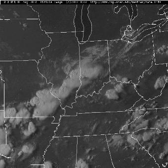
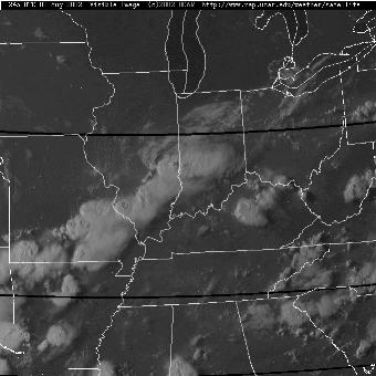
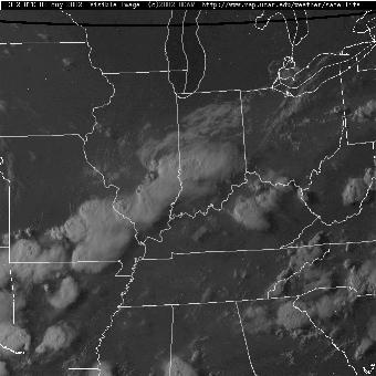
Thanks to Georgia Reams above, you can see a page of all eight Midwest Satellite shots I took Friday on a single page. What you'll notice is the whiter REAL clouds move and OVERTAKE the paler CHEMTRAIL material farther EAST than when they started. This is because CHEMTRAILS are ALWAYS sprayed ahead of and ABOVE normal rain clouds. This made the 'process' easy to capture using regular satellite imaging 15 minutes apart. The effect you see from the GROUND is watching the building thuderheads become DIFFUSED and become a whitish light grey in appearance. The loud thunder begins to die off.... then finally NO RAIN save for possibly a brief 'misty drizzle' if anything at all! You can actually see the definition of the clouds CHANGED in these satellite photos. The one on the left is at the beginning of the series. And the one on the right is the LAST of the series. See how the definition becomes fuzzier? If you go to the CHEMTRAILS PAGE at http://groups.yahoo.com/group/LLNews (you don't have to be a member to get into LLNEWS) and click on any of the 'Death of a rainstorm' links... you'll see how a thunderstom appears as it's being 'MODIFIED.' I've got about 4 of the FULL sized Midwest photos sent to LLNews. I'll continue sending these 1 per day so I don't overwhelm those LLNewsmembers getting mail from there.